Award winner: Excellence in Surveying & Spatial Information (EISSI) Awards - 2024 Winner of the Urban Cadastral Surveying & Land Titling category.

Peter Boorer
Manager Survey, NSW
Overview
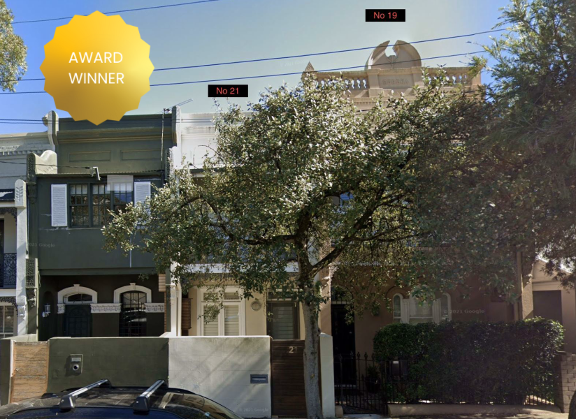
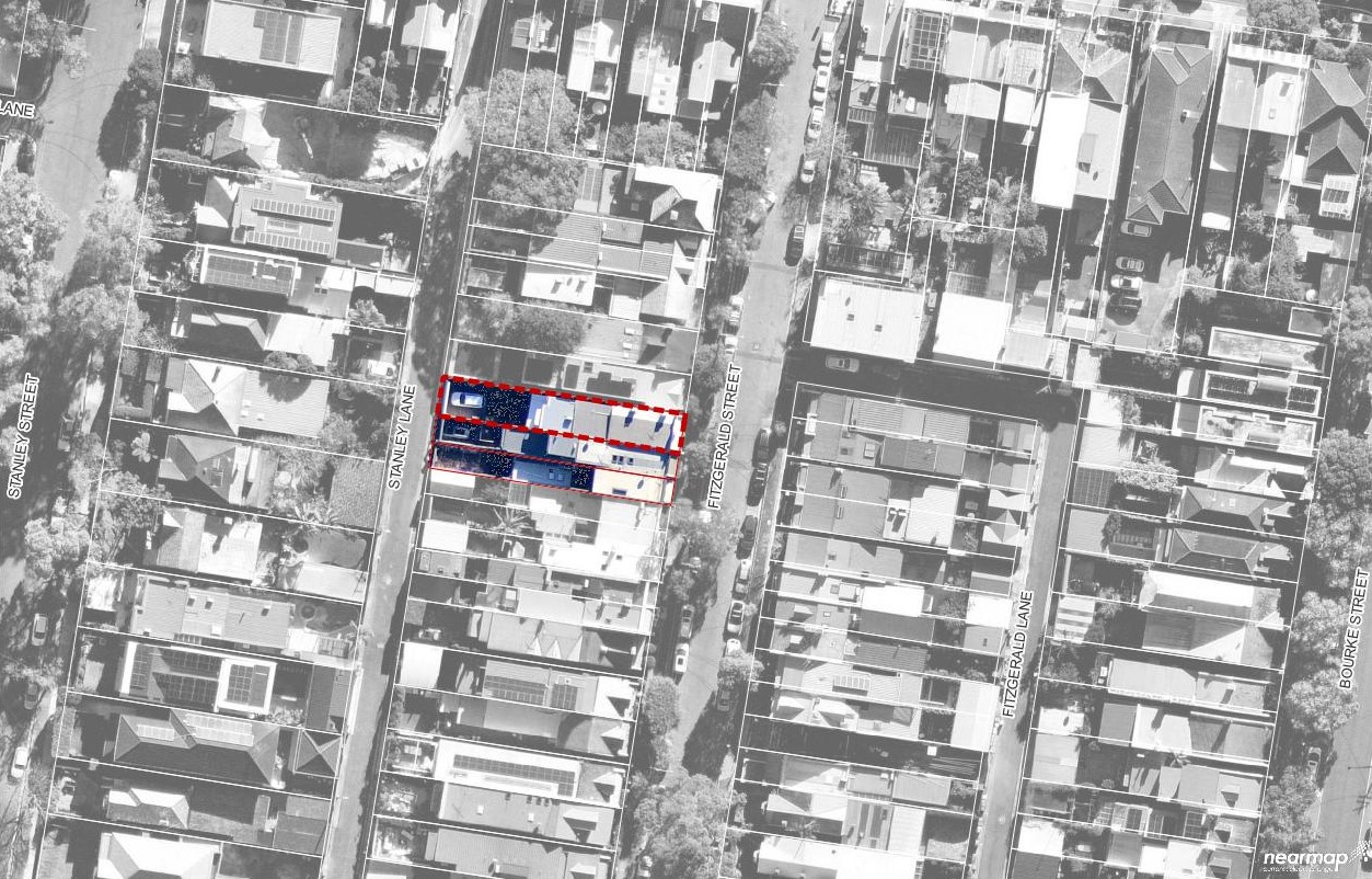
Beveridge Williams was engaged by the landowners of 19 Fitzgerald St, Queens Park, to assist with a delimitation survey to satisfy the Council’s consent condition for the landowner to construct a new garage at the rear of their property. This routine task evolved into an adverse possession claim involving two reasonable survey plans for adjoining sites. The assumption that both were Torrens titles made the project particularly intriguing. The plan shifted to a consolidation plan involving a limited title lot defined only by metes and bounds and a residue in the adjoining title with a small hiatus between deeds included in the adverse possession component.
Work Undertaken
Our initial search revealed that the plan for the lot to the north was registered in 2015 and is full Torrens title. The plan for the southern side, registered in 1956, was initially thought to be full Torrens title, but further investigation revealed it to be limited Torrens title. This southern boundary, from DP908841, included a 9” brick party wall. There was no notation on either title regarding an easement to support the wall, and our client believed the wall was part of their original pre-1900 dwelling. The neighbouring dwelling at No. 21 is a two-story infill terrace built post-1900.
The survey of Fitzgerald Street and Stanley Lane was inconsistent, covering approximately 200m from Birrell Street at the northern end to Cuthbert Street at the southern end. Previous surveyors had limited their surveys to either the northern or southern ends without providing information for the entire block, with one surveyor re-referencing cadastral marks at the northern end while affecting titles at the southern extremity.
The project became more challenging when our clients wished to retain ownership of the wall, believing it was part of their dwelling rather than a party wall. Upon obtaining a historical title search report, it was discovered that ‘1 brick’ of the 9” brick party wall had been sold to the adjoining owner in the 1930s. This discovery necessitated additional surveys to accurately measure the wall from inside both No. 19 and No. 21, from front to back and on both levels.
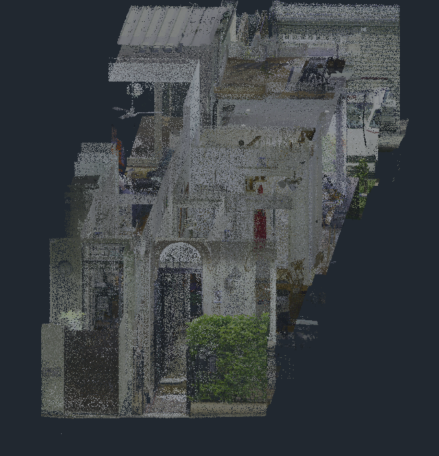
Our approach to this project significantly raised awareness of the surveying industry within the community and enhanced our profile as a profession through several key aspects. By utilizing terrestrial laser scanning, we demonstrated the advanced accuracy achievable with modern technology compared to conventional survey methods. This high level of precision highlighted the critical role of surveyors in ensuring exact boundary determinations and property delineations, instilling public confidence in the reliability of survey data.
Creating a detailed point cloud allowed for continuous review and extraction of additional information without the need to revisit the site. This comprehensive data collection showcased the capabilities of modern surveying tools and emphasized the value of thorough and meticulous survey practices. Additionally, the detailed data provided valuable insights for architects, engineers, and legal professionals, fostering a greater appreciation for the surveyor’s role in interdisciplinary projects.
Our approach minimized disruption to the properties and expedited the overall project timeline, demonstrating how modern surveying methods can save time and reduce inconvenience, which appealed to both property owners and project stakeholders. The reduced disruption and quicker project completion were well-received by the community, enhancing the perception of surveyors as efficient and considerate professionals. Through leveraging advanced technology and creative approaches, we showcased the innovative potential of the surveying industry. This not only resolved the complex survey issues but also positioned us as forward-thinking leaders in the field. By adopting and demonstrating these advanced surveying methods, we successfully resolved the project challenges, provided precise and reliable data, and significantly boosted the awareness and profile of the surveying profession in the eyes of the community and allied professionals.
Our team were recognised by the Surveying and Spatial Information profession as the provider of excellent urban cadastral expertise. We won the 2024 EISSI Award for Urban Cadastral Surveying & Land Titling Award for Queens Park. In awarding the BW team, the judges concluded, “This project involved navigating intricate boundary and titling issues, and the team expertly merged traditional and modern surveying techniques to achieve outstanding results. The judges highlighted how this project not only delivered precise data but also elevated the profile of the surveying profession in the community.”