Beveridge Williams: Elevating Surveying with Drone, Scanning & BIM Innovation
Beveridge Williams is redefining spatial intelligence through advanced drone surveying, multi-platform laser scanning (ground, airborne and vehicle), and BIM—delivering precision, speed, and clarity across every phase of development.
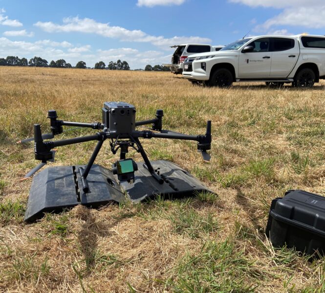
- Drone & Aerial LiDAR Surveying
- Using UAV platforms equipped with high-resolution sensors and LiDAR, BW captures detailed spatial data across vast and challenging terrains. These aerial surveys offer:
- Rapid coverage of large or inaccessible areas
- Vegetation-penetrating LiDAR for accurate terrain modelling
- Georeferenced outputs for seamless integration into GIS and BIM workflows
- Orthophoto generation for distortion-free mapping
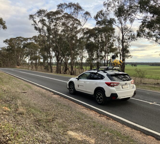
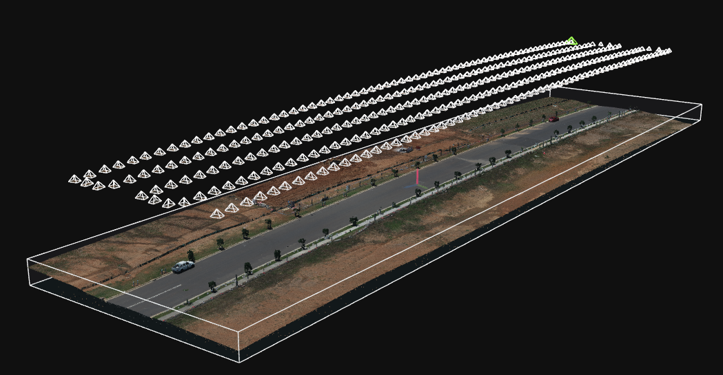
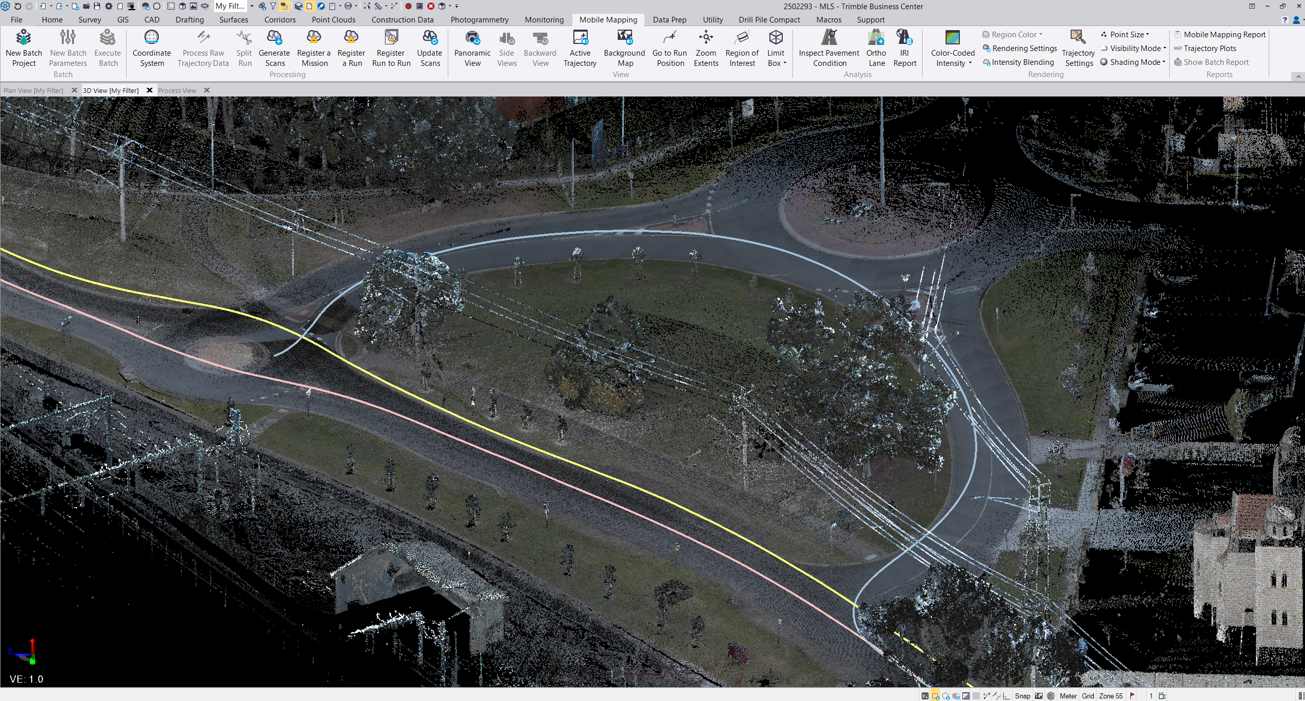
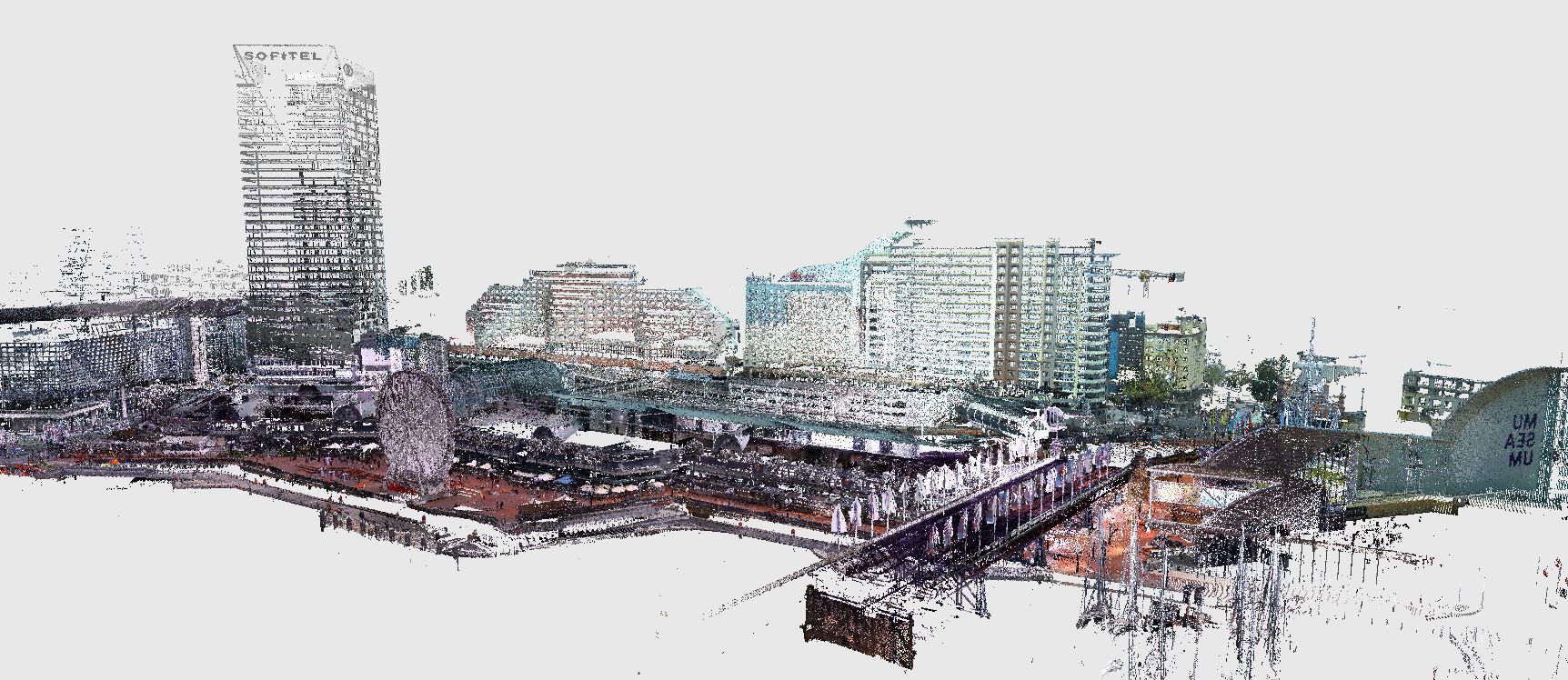
Terrestrial & Mobile Laser Scanning
BW deploys both static and vehicle-mounted laser scanning systems to suit the environment and project scale:
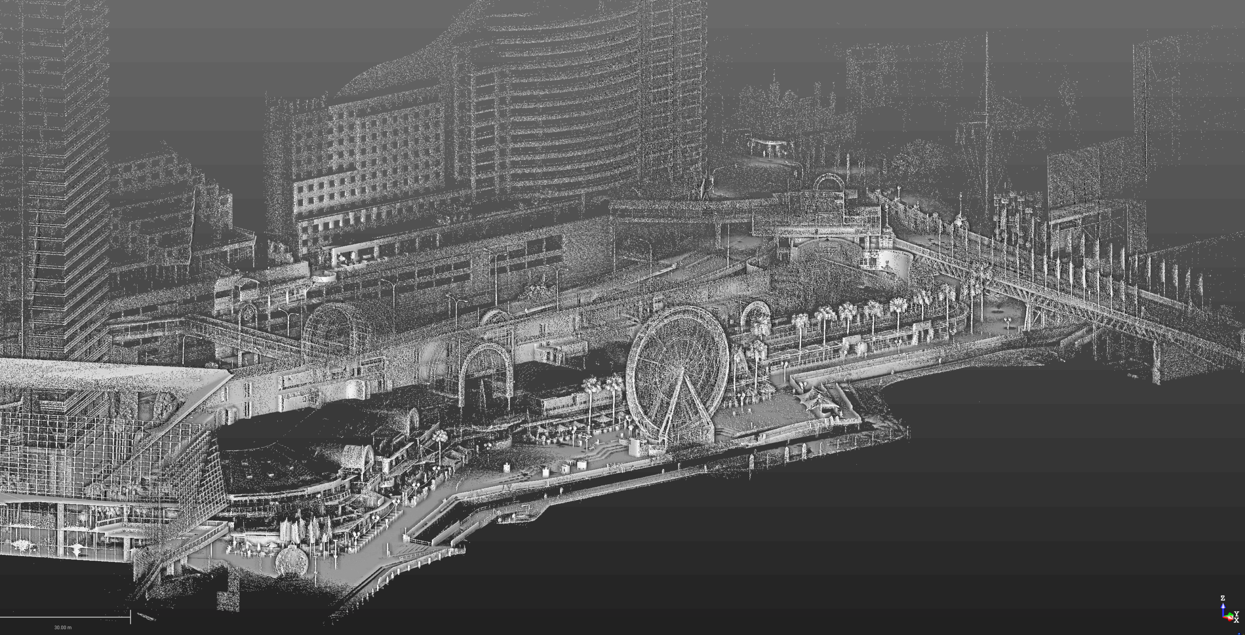
- Terrestrial laser scanning (TLS) provides millimetre-accurate point clouds for all sites, including built environments, ecology, and greenfield sites.
- Mobile laser scanning (MLS) enables efficient corridor mapping for roads, rail, and urban infrastructure—capturing streetscapes and linear assets with speed and precision.
- All scans can be processed into dense 3D models and digital twins, supporting design, clash detection, and asset management.
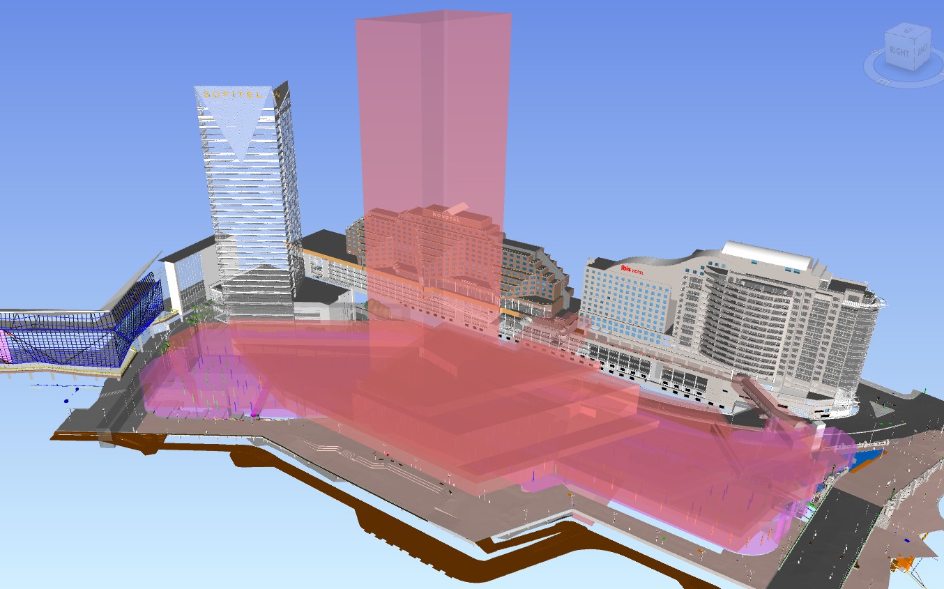
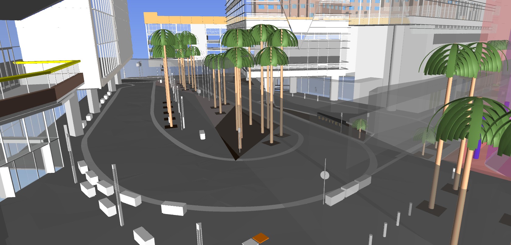
BIM Integration & Digital Modelling
Beveridge Williams transforms spatial data into intelligent BIM models that:
- Embed technical metadata for lifecycle planning
- Support Scan-to-BIM workflows for renovations and retrofits
- Enable collaborative design, construction monitoring, and future-proof planning
GIS-Enabled Workflows with QGIS
Spatial outputs may be integrated into QGIS, allowing:
- Layered analysis with planning overlays, cadastral data, and environmental constraints
- Custom symbology and styling for stakeholder engagement
- Plugin-based workflows for LiDAR, terrain modelling, and BIM coordination
Industry Recognition & Best Practice
With an award-winning reputation for technical excellence and innovation, BW applies best-practice methodologies including:
- Ground control validation for spatial accuracy
- Scan-to-BIM and GIS integration for end-to-end project intelligence
Whether it’s a metro tunnel, a mixed-use precinct, greenfield, or a heritage restoration, Beveridge Williams combines technology, expertise, and insight to deliver spatial solutions that drive better decisions.